Oludeniz Maps and Orientation
(Oludeniz, Mugla Province, Turkey)
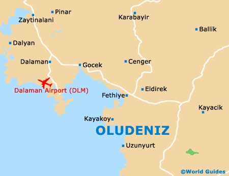
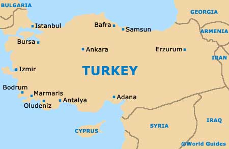
Oludeniz lies in the south-west of the country, in the Mugla Province. The resort sits just south of the town of Fethiye on the so-called 'Turquoise Coast', a region rich with the bluest of blue waters and dazzling beaches.
Antalya is off to the east, with
Bodrum to the north-west.
The town is actually made up of three parts - the original village of Oludeniz (now the beach resort), the main beach and lagoon known as Belcekiz, and the two villages of Ovacik and Hisaronu (further inland). For clarity, the area in its entirety is today regarded as Oludeniz.
Maps and Orientation of the Town / Resort
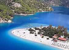
Oludeniz is made up of a network of small streets behind the beach, 17 km / 11 miles south of Fethiye. In front of the town and to the west is Belcekiz beach, while to the north-west is the Blue Lagoon. These are all within walking distance. The older villages of Ovacik and Hisaronu are some 2 km / 1.5 miles behind the beach area.
Behind the resort and villages again are the Taurus Mountains, with the terrain climbing steadily before dropping off again heading into Fethiye. Maps of Oludeniz can be purchased online before you travel, or at any good resort at the beach end. Shops in the older villages also stock local maps.
- Antalya - 205 km / 128 miles (three hours and 40 minutes, east)
- Bodrum - 240 km / 149 miles (four hours and 20 minutes, north-west)
- Butterfly Valley - 15 km / 9 miles (25 minutes, south)
- Dalaman - 53 km / 33 miles (one hour and 15 minutes, north-west)
- Dalyan - 71 km / 44 miles (one hour and 20 minutes, north-west)
- Fethiye - 12 km / 7 miles (20 minutes, north)
- Hisaronu - 3 km / 2 miles (ten minutes, north)
- Izmir - 347 km / 216 miles (five hours and 30 minutes, north-west)
- Kayakoy - 6 km / 4 miles (12 minutes, west)
- Marmaris - 138 km / 85 miles (two hours and 40 minutes, north-west)
- Saklikent Gorge - 53 km / 33 miles (one hour and 10 minutes, south-east)
- Xanthos - 73 km / 45 miles (one hour and 20 minutes, south-east)
Map of Turkey
Map of Oludeniz